The Manitou Incline: Colorado's Legendary Staircase to the Sky
Nestled within the rugged terrains of Colorado lies a test of physical endurance and mental tenacity that attracts thousands of adventure seekers every year. The Manitou Incline, often simply referred to as "The Incline," is a popular hiking trail near Colorado Springs that has gained notoriety for its relentless steepness, striking views, and the unparalleled sense of accomplishment it bestows upon its conquerors.
Historical Origins
The Manitou Incline was originally built as a cable car track in the early 1900s to serve the needs of pipelines and hydroelectric utilities. Later, it became a tourist attraction. The cable car ride offered breathtaking panoramic views of the surrounding region. However, after many years of operation, a rockslide damaged the tracks in 1990, and the decision was made not to rebuild them. Instead, the remnants of the tracks would evolve into one of Colorado’s most unique and challenging hikes.
The Trail’s Profile
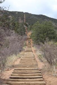
The Incline is a mere 1 mile in length, but don't be fooled by its short distance. What it lacks in length, it compensates for in gradient. The trail ascends rapidly over 2,000 feet from start to finish, with an average grade of 24% and sections as steep as 68%. The "trail" is essentially a staircase composed of nearly 2,800 steps made from the old cable car railway ties.
Taking the Challenge
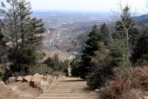
Every year, athletes, locals, and tourists challenge themselves to tackle this grueling ascent. Some aim to beat personal records, while others aspire to simply reach the top. The Incline offers no reprieve; its relentless steepness is both its appeal and its challenge. As hikers make the ascent, they are rewarded with increasingly majestic views of Manitou Springs, Colorado Springs, and the expansive plains beyond.
At the top, the feeling of accomplishment is palpable. For many, conquering The Incline becomes a rite of passage, a benchmark of physical and mental determination.
Safety and Considerations
Given the demanding nature of the trail, it's essential to be prepared:
- Fitness Level: Ensure you're physically fit and acclimated to Colorado's altitude. The rapid elevation gain can affect even seasoned hikers.
- Weather: The weather can change quickly. Bring layers, sunscreen, and plenty of water.
- Trail Etiquette: The Incline is popular, so be courteous to fellow hikers. Those ascending have the right of way.
- Descent: While you might be tempted to descend the same way you came up, it’s recommended to take the Barr Trail down, which offers a longer but gentler descent.
My Trip To Manitou Incline
On Friday, April 1st, 2022, I hiked the Manitou Incline Trail near Manitou Springs, Colorado just before noon. It was about 4 miles from the parking lot, up the incline and down Barr Trail, taking me just under 2.5 hours roundtrip.
Before arriving, you need to have a reservation (see: details here). It is a free reservation and I was not asked for it possibly before it was not as busy as in summer months. Once there, you can park for $10 USD which gives you 4 hours.
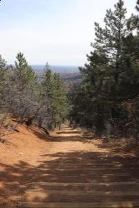
The hike up is steep and it is difficult to complete it without stopping. You gain about 2,000 feet in elevation from the hike up. It took me just under an hour to get to the top of the incline, stopping several times. There are spots along the hike up where you can connect to the Barr Trail down.
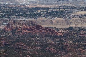
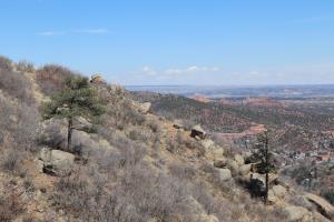
Once at top, you can see the town and far off into the distance. The way down via Barr Trail is recommended instead of descending the steps. Parts of the incline are very steep with small distances between steps. Overall, it is a challenging yet important hike to do.
No Comments
