Wheeler Trail: A High Alpine Odyssey from Breckenridge to Copper Mountain
Colorado, known for its sprawling mountain landscapes and vibrant outdoor culture, boasts a myriad of trails that cater to adventurers of all types. Among these, the Wheeler Trail stands out. Snaking its way from the historic town of Breckenridge to the renowned Copper Mountain, this trail offers a journey through some of the state's most exquisite alpine terrains.
An Overview
The Wheeler Trail stretches approximately 10.5 miles, connecting Breckenridge and Copper Mountain. It's a hike that demands effort and endurance, taking adventurers through dense forests, alpine meadows, and over the Tenmile Range, with the trail peaking at elevations surpassing 12,000 feet.
The Journey Begins: Breckenridge
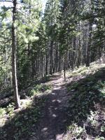
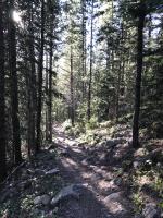
Starting in Breckenridge, a town celebrated for its skiing and rich gold-mining history, the Wheeler Trail begins its ascent almost immediately. The trailhead at the south end of town guides hikers through a canopy of spruce and fir trees, with the early stages of the trail being a gentle introduction to the rigorous climb ahead.
Reaching the Heights: Tenmile Range
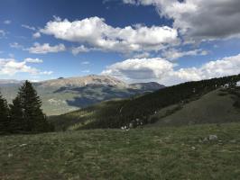
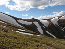
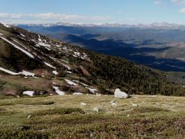
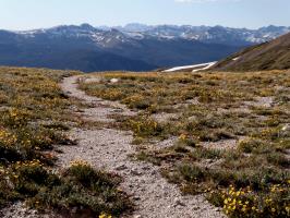
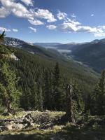
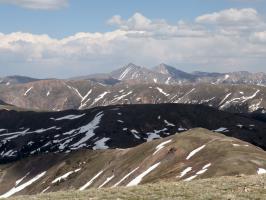
As hikers approach the Tenmile Range, the trail becomes more strenuous, but the rewards are unparalleled. The sweeping vistas of surrounding peaks, coupled with pockets of wildflowers during the summer months, make the exertion worthwhile. From this vantage point, one can take in the grandeur of surrounding landmarks, including Peaks 8 and 9, which are particularly popular among skiers in winter.
Descending to Copper Mountain
After conquering the trail's highest points, the descent towards Copper Mountain is a mix of meandering paths through subalpine landscapes and steeper sections that test a hiker's agility. Copper Mountain, primarily known for its ski resort, serves as a welcoming endpoint, offering an array of amenities and the promise of rest.
Flora and Fauna
The varying elevations of the Wheeler Trail provide habitats for diverse plant and animal life. From the blue spruce and aspen trees in lower elevations to the hardy alpine wildflowers like the Colorado columbine at higher altitudes, the trail is a botanist's dream. Wildlife enthusiasts might spot mule deer, pikas, marmots, and even the occasional mountain goat.
My Tiime Hiking The Wheeler Trail
I decided to hike from Breckenridge to Copper Mountain on June 24th, 2017, starting at about 2:15PM and arriving at about 8:00PM.
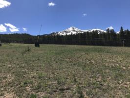
I started the trail at the base of Peak 8 in Breckenridge, following a road and then eventually leaving it to a hiking/ biking trail. This trail did not connect to the remaining part of the road I needed to connect to and so I ended up needing to cross a river and going up steep terrain.
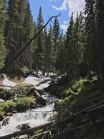
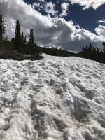
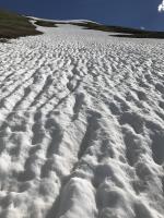
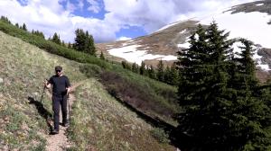
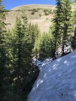
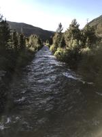
The river, or stream, that I crossed was quite large and I had to jump on a log to cross it. There were mosquitoes near the river. Once I crossed it, I had some steep hiking to get back to the road which connects to the Wheeler Trail. It is possible to drive on this road most of the way to Wheeler Trail but some sections were packed with deep snow, which I needed to traverse.
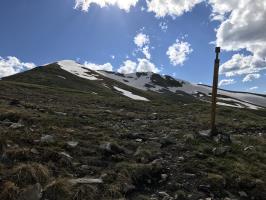
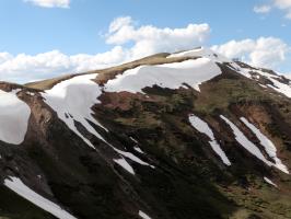
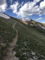
Once I got to the Wheeler Trail, I had to continue through a few patches of snow before making it up to the ridge. Once at the ridge, it was downhill into Copper. I saw two lone bikers on the Colorado Trail before patches of snow. They were near where the Colorado Trail connects to the Wheeler Trail.
After I got to Copper, I returned to Breckenridge by bus. First, I was able to take the Summit Stage to Frisco and then take another bus line back to Breckenridge. The weather was overall quite good, I did not need to wear a jacket the entire time. There were some wind gusts and some steep terrain but overall it was possible to do the entire trail in under 6 hours, despite going off the path for about 1/4th of it.
Trail Tips
If you're planning to embark on the Wheeler Trail:
-
Preparation: The trail's length and elevation changes require stamina. Ensure you're well-prepared with adequate water, snacks, and suitable hiking gear.
-
Weather: Mountain weather is unpredictable. Be equipped for sudden changes, especially at higher elevations where it can get chilly, even in summer.
-
Navigation: While the trail is generally well-marked, carrying a map or GPS can be beneficial, especially if venturing off the main path.
Conclusion
The Wheeler Trail, connecting Breckenridge to Copper Mountain, serves as a testament to Colorado's alpine splendor. Whether you're seeking the thrill of scaling the Tenmile Range or simply wish to immerse yourself in the state's pristine wilderness, this trail offers an experience that lingers in memory long after the journey's end.
No Comments
